Riding on the Ice Road

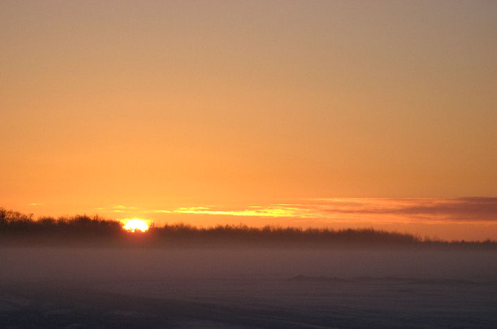
Sunday, December 24th, was a beautiful afternoon to go out for a truck ride on the river. The weather has been consistently colder than +10F for several days, and the wind has been quiet for the last two days. The day dawned clear and bright just before 11 am and the sun shone strong and low in a deeply blue sky all day. It was a perfect time to be out.
 Henry came by in mid-afternoon to see if Dutch and I felt like a short river trip. People have been traveling on the river in cars and trucks for about two weeks now, and the word around town is that the river is safe and the
The
 Because the lower
The tidal influence exists for the last ninety miles or so before the river empties into
Tidal changes and the natural seasonal decrease in the amount of water in the river also cause the huge plate of ice that is the river’s surface to drop, sometimes five feet or more. This causes large ragged shelves of ice running along the river banks. They must be crossed to get out on to the river where the ice is smooth. In some years, chain-saw ice sculpting is required.
The type of weather we have in October and November determines the quality and character of the
 Depending on the condition of the river ice, the Ice Road may go as far upriver as the village of Aniak, 150 miles away, and as far downriver as the confluence with the Johnson River, about 20 miles. Most years it gets as far up as Tuluksak, about 75 miles away. It always gets to Kwethluk, 15 miles away. In the past, the
The state of the
 The path on to the river ice is currently good at the small boat harbor. No rough jumble, big dropoffs, or overflow problems. The trail is easy to see and follow. Not much traffic was out; every ten minutes or so, we’d see another car, truck or snowmachine. Every time we stopped to take pictures and drink some coffee, people would stop to ask if we needed help. Every single vehicle. Every time. Not a single person passed us without inquiring. It is very reassuring that if you get stuck, someone will help you.
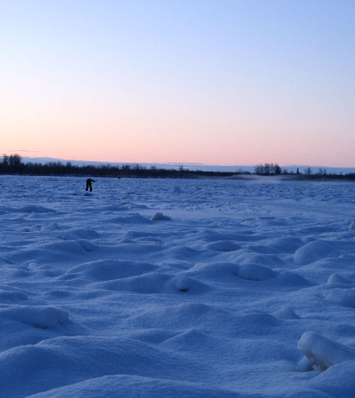
About five miles upriver we came around a wind-swept bend in the river to find ourselves on the craters of the moon. The jumble ice was so rough and big the road took a serpentine path that quadrupled its length to cover the distance. We bounced slowly along at walking pace for about two miles before the ice was smooth again. Halfway through this section we came upon a man with an ice chisel in his hand, working all alone out on the river. We stopped to talk when we passed him; he said this part of the trail was just too rough, so he was smoothing it out a little. On our way back about two hours later, he had made quite a difference.
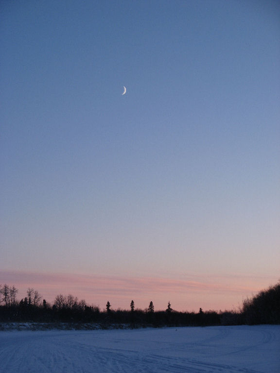
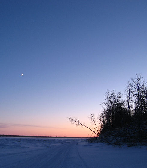
The sun was not far from setting when we left town about 4 pm, and much of our ride was in twilight with the moon rising. It was a perfectly beautiful afternoon. Calm and clear with no wind, about ten above zero. Completely quiet, except for the occasional passing truck. We made it almost to Kwethluk before we turned back. It was wonderful to have a little wilderness injection in the midst of the holiday weekend.
Photos by The Tundra PA
Labels: Life in Bethel
posted by The Tundra PA at 9:43 PM
![]()


7 Comments:
Dang. I miss that. More than you might guess . . .
Just dang.
Ah, Ice roads. Yup, it's definately a bit unnerving the first few times, but what a great explanation about them.
T.C.
Beautiful...just beautiful. Both the pictures and your narration. I find myself addicted to Alaska, wishing I were there instead of here in Alabama. Is it possible to be addicted to something you have never experienced? Hoping your holiday was happy and not too busy!!
Laura
Lovely, evocative piece again.
Regards - Shinga
John--no Ice Road in Houston, ah? Alaska misses you!
TC--what really gets me is when you stop, get out of the truck, and then hear the rifle-shot sound of ice cracking. Intellectually, I know that five feet of river ice are not going to part suddenly and allow my truck to sink to the bottom of the river. But the movie camera in my mind's eye sure does a stunning clip of my truck doing a "Titanic".
Laura--it's not as far as you might think from Alabama to Alaska. I was born there, now I'm here. The climate is a bit more harsh, but the people are sure nice! Get yourself up here for a visit; you'll never regret it. Maybe you'll even decide to stay.
Shinga--thank you!
beautiful pictures
Wonderful...
Post a Comment
<< Home